
This monthly update provides a snapshot of the Emissions Reduction Fund, including interesting insights into some of the projects on the Emissions Reduction Fund project register. The below data does not include information on revoked projects. Data from revoked projects is available in the Emissions Reduction Fund project register.
Emissions Reduction Fund projects across Australia
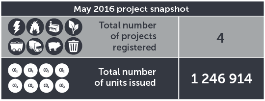
This graphic shows a summary of activity for the Emissions Reduction Fund in May 2016.
Emissions Reduction Fund projects by method type
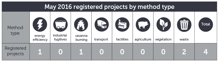
This graphic shows the total number of Emissions Reduction Fund projects registered in May 2016, broken down by method type.
Emissions Reduction Fund projects across Australia
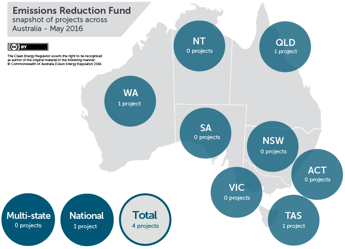
This map shows the total number of Emissions Reduction Fund projects registered in each state and territory across Australia in May 2016.
#Mapmycarbon with the Clean Energy Regulator’s new interactive project map
The Emissions Reduction Fund project map is an interactive map of Australia which provides an ‘at a glance’ view of projects registered under the Emissions Reduction Fund. The project map includes simple pie chart information about the number and type of projects in each state or territory, and pins which geographically plot project location by postcode.
View the interactive map here to find out what’s happening in your area.